|
ACTIVITIES AND
LESSON PLANS:
4. For Lands’ Sake
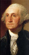
WASHINGTON'S LIFE:
|
|

FOR LANDS’ SAKE: GEORGE WASHINGTON AS LAND SURVEYOR
Objectives:
- To discuss the importance of land ownership and the purpose of land surveying in the eighteenth century
- To read and interpret a transcript of an eighteenth-century land survey
- To reflect on the significance of George Washington’s early surveying career and how it contributed to his personal development
- To survey an area of land and create a written or visual description of it
- To construct a piece of historical fiction (for example, a journal entry, newspaper article, or letter) that demonstrates an understanding of Washington’s qualifications for and interest in becoming a land surveyor
Related standards in historical thinking:
- Historical comprehension: reconstruct the literal meaning of a historical passage; read historical narrative imaginatively
- Historical analysis and interpretation: identify the author of a historical document
- Historical research: formulate historical questions; obtain historical data; marshal needed knowledge of the time and place to construct a story, explanation, historical narrative, or interpretation
Materials:
- “For Lands’ Sake: George Washington as Land Surveyor” background information (see below)
- “Interpreting an Eighteenth-Century Land Survey” student worksheet (see below)
- Paper
- Pencils or pens
- Extra-long measuring tape or other measuring tool
- Directional compass
Procedures:
- Ask the students to:
- Define or explain land surveying and its importance during the eighteenth century
- Explain the value of owning land during the eighteenth century
- Explain why land surveying was a good career choice for George Washington
- Describe how understanding the wilderness helped Washington later in life
- Tell the students to read the background information on George Washington and his interest in land surveying.
- Explain that Washington was appointed surveyor for Culpeper County, Virginia, in 1749, at the age of seventeen. Ask the students to write a letter explaining why he would have liked the job of county surveyor, mentioning his interests in and qualifications for the job.
- Distribute the worksheet, “Interpreting an Eighteenth-Century Land Survey.” Ask the students to read the land survey and answer the questions that follow.
- Explain to the students that eighteenth-century land surveying parties often consisted of up to twenty people, including a cook, a lead surveyor, and others who performed various jobs such as measuring, flagging, and clearing land. Tell the students that, like a surveying party, they need to work together to complete this project. The project can be completed as a whole class or as a small group project.
- Ask the students to take a nature walk and imagine that they are walking in uncharted territory. Have them sketch a picture of the area that includes as many landmarks as possible. They should take notes on the area, keeping an accurate count of any landmarks. They must decide what the boundaries will be and think about different ways to mark off and measure the area. Assign the students different tasks in the marking and measuring of the boundaries. Give them a measuring tool to measure the boundary lines. George Washington primarily used a compass and chains, along with a sector, parallel rule, and circular protractor.
- Back in the classroom or as a homework assignment, ask the students to create a written and visual description of the land they have “surveyed.”
- If the “uncharted territory” is safe and nearby, allow students from another class to try to locate the area based on the written and visual descriptions. If going to the site is impractical or not possible, ask other students to try to identify the location based on the visual and written descriptions.
- Display the visual and written descriptions.
Background Information
For Lands’ Sake: George Washington as Land Surveyor
Owning land was one of the main ways a person had wealth and status in eighteenth-century Virginia. Washington wanted both. However, in order to acquire land, Washington first needed money. Land surveying, or determining boundaries of land, offered a good way to earn money while also enabling a person to explore land that might be available for purchase.
Washington was good in math, drafting, and horseback riding, and he loved and appreciated the outdoors. These skills and interests made him an ideal candidate for a land surveyor. He studied land surveying using his father’s surveying instruments. His half-brother Lawrence introduced him to Lord Fairfax, the most important landowner in Virginia. Lord Fairfax invited the fifteen-year-old Washington to participate in a land surveying expedition. This experience inspired Washington to pursue a career in land surveying, which gave him an opportunity to earn a living. It also allowed him to explore the wilderness and the frontier of Virginia, and enabled him to find and purchase pieces of land that he liked. By the age of seventeen, Washington was a successful land surveyor. He was very popular and sought-after as a surveyor because he was honest and accurate.
Washington’s interest in investing in land continued throughout his life. When the U.S. Congress voted to move the federal capital from Philadelphia to a permanent location, President Washington selected a site along the Potomac River, where he and others owned land. Although he was never President in this new city, now known as Washington, D.C., it became the government’s permanent home in 1800.
Student Worksheet
For Lands’ Sake: George Washington as Land Surveyor
Interpreting an Eighteenth-Century Land Survey
Read the following eighteenth-century land survey and answer the questions that follow.
George Washington. Land Survey for Daniel Osborne, Frederick County, Virginia, March 30, 1752
(Original document at the Lilly Library at Indiana University, American History Documents)
By Virtue of a Warrant from the Proprietors Office I have Surveyed for Daniel Osborne a certain tract of waste and ungranted land on Potomack joining the upper Side of Daniel Pursleys Land & Bounded as followeth Beginning at two Ashes and an Elm on the river Pursleys Corner and extended up the Meanders of the River N0.61.W. Twenty poles . . . N0.650.W. One hundd. and Eighty poles to a double and Single hoop Wood trees thence S0200.W. Two hundred and Sixty poles to a Large Pine on the point of a hill. thence S0.770.E. Two hundd. and Seventy poles to a white Oak and red Oak Danl. Pursleys Corner . . . thence with his Lines N0.250.W. Two hundd. poles to two chestnut Oaks on the side of a hill & . . . Finally N0.650.W. One hundd. poles to the Beginning Containing Two hundd. and Seventy Acres this 30th: day of March 1752.
John Lonem . . . .
Cornelius Williams -- C.C.
Peter Pursley-M[arker]
G:Washington
- Who wrote this land survey?
- When and where was this land survey completed?
- For whom was the land survey done?
- How does Washington describe the land?
- Whose land joins the surveyed land?
- What kind of landmarks does Washington use to describe the land boundaries?
- Name at least two different landmarks that he mentions.
- What unit of measure does Washington use?
- What is the total number of acres in this land survey?
|